Join us
Seeking PhD students
We are seeking outstanding students for PhD Graduate Assistantship positions in Urban Computing. The successful candidate will be enrolled in Doctor of Philosophy Program in Urban and Regional Science.
The students will work on several federal projects on disaster science and urban informatics with a group of collaborators from urban planning, civil engineering, computer science, geography, and sociology.
Applicants should have experience in urban big data analytics on one or more of the following methodological fronts: natural language processing, network science, computer vision, geospatial artificial intelligence, urban simulation, or any innovative method.
The program has strong ties to the world-renowned Hazard Reduction & Recovery Center, Texas A&M Transportation Institute, the Center for Health Systems & Design, Texas A&M Institute of Data Science, and other centers. Support for collaborative and innovative research is excellent.
Please contact Professor Xinyue Ye at xinyue.ye@tamu.edu for more information.
Projects

DSL-FR
DSL-FR(Domain Specific Language for Flooding Resilience) is a programming language designed to bridge the gap between domain scientists and programmers, make it easier to write high readability code for image processing tasks.

lockdownEva
Evaluating the effect of city lockdown.

GIS-KG
Building A Large-Scale Hierarchical Knowledge Graph for Geographic Information Science and Technology

First-Floor-Elevation
Detect the First Floor Elevation based on street view images
OKN
This project will advance research critical to the development of open knowledge networks (OKN) through the combination and testing of participatory and automated ontology development processes. Three domain-specific case studies (wildland fire, water quality, and biodiversity conservation) will build on participatory Geographic Information System (GIS) and ontology development work through engagement of problem-focused stakeholder networks. At the same time, the utility of automated tools for resource discovery, ontology development, and social network analysis will be tested in these real-world problem environments. Through integration and comparison of these techniques, the project team will deliver insights into efficient and effective methods for OKN development.
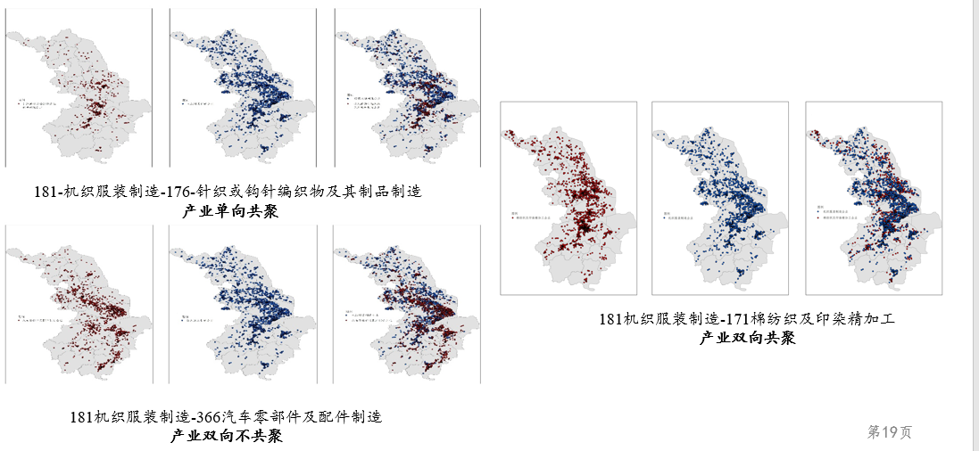
Colocation/Coagglomeration Index
Industrial Colocation index is based on the researches of Billings and Johnson(2016) and Lu Chen et al.(2020). The index uses the longitude and latitude coordinates of enterprises to study the spatial group location rules among industries. The program is based on the Wasserstein distance algorithm of machine learning, combined with Sinkhorn and entropy regularity optimization algorithm, to calculate the similarity of the two industries in the spatial distribution. Finally, we calculate the Colocation Index through Monte Carlo simulation and hypothesis test.
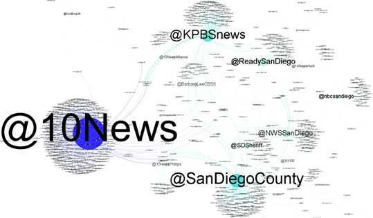
SocialNetworkSimulator
A software that enable spatio-temporal social network analysis and simulation
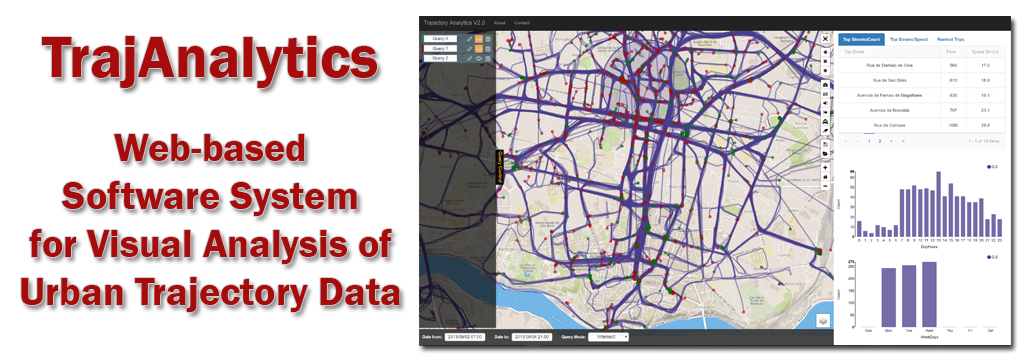
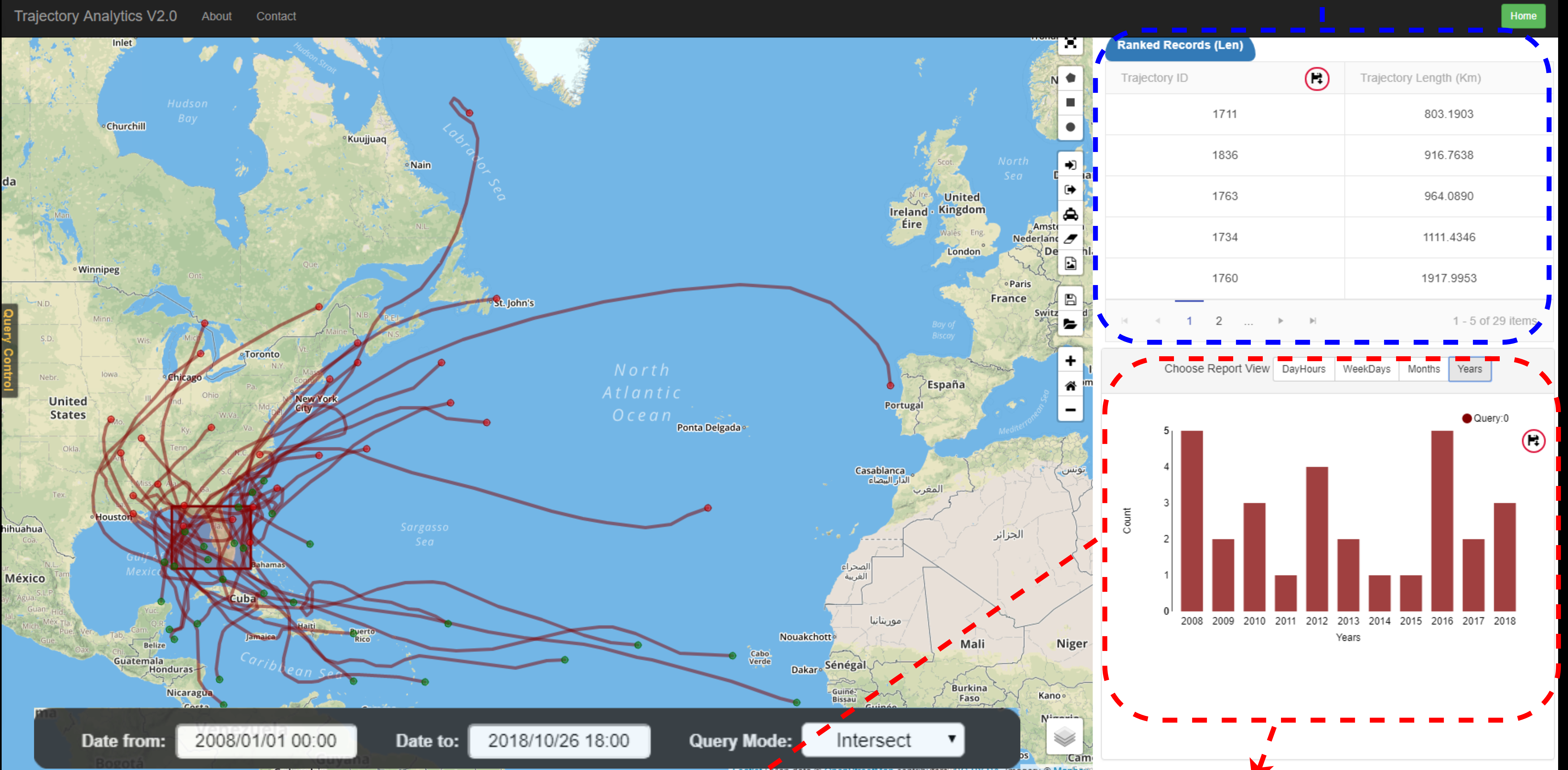
TrajAnalytics
A Free Software for Visually Exploring Urban Trajectories
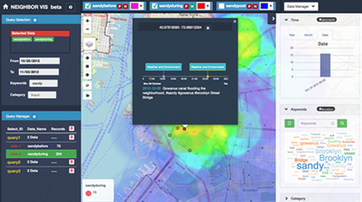
NeighborVis
A Visual Analytics System of Geospatial-Semantic Event Data in Localized Neighborhoods
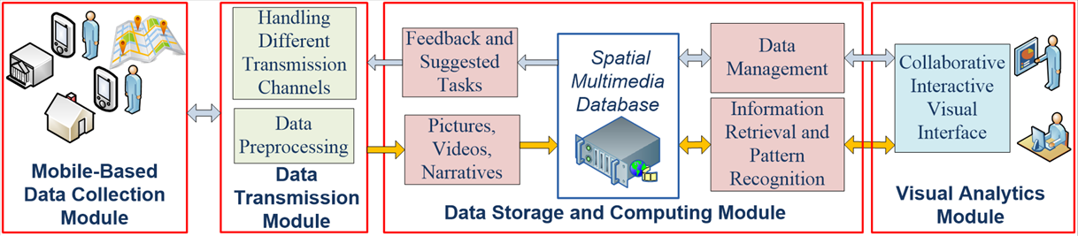
GeoVisuals
Capturing, Managing, and Utilizing GeoSpatial Multimedia Data for Collaborative Field Research
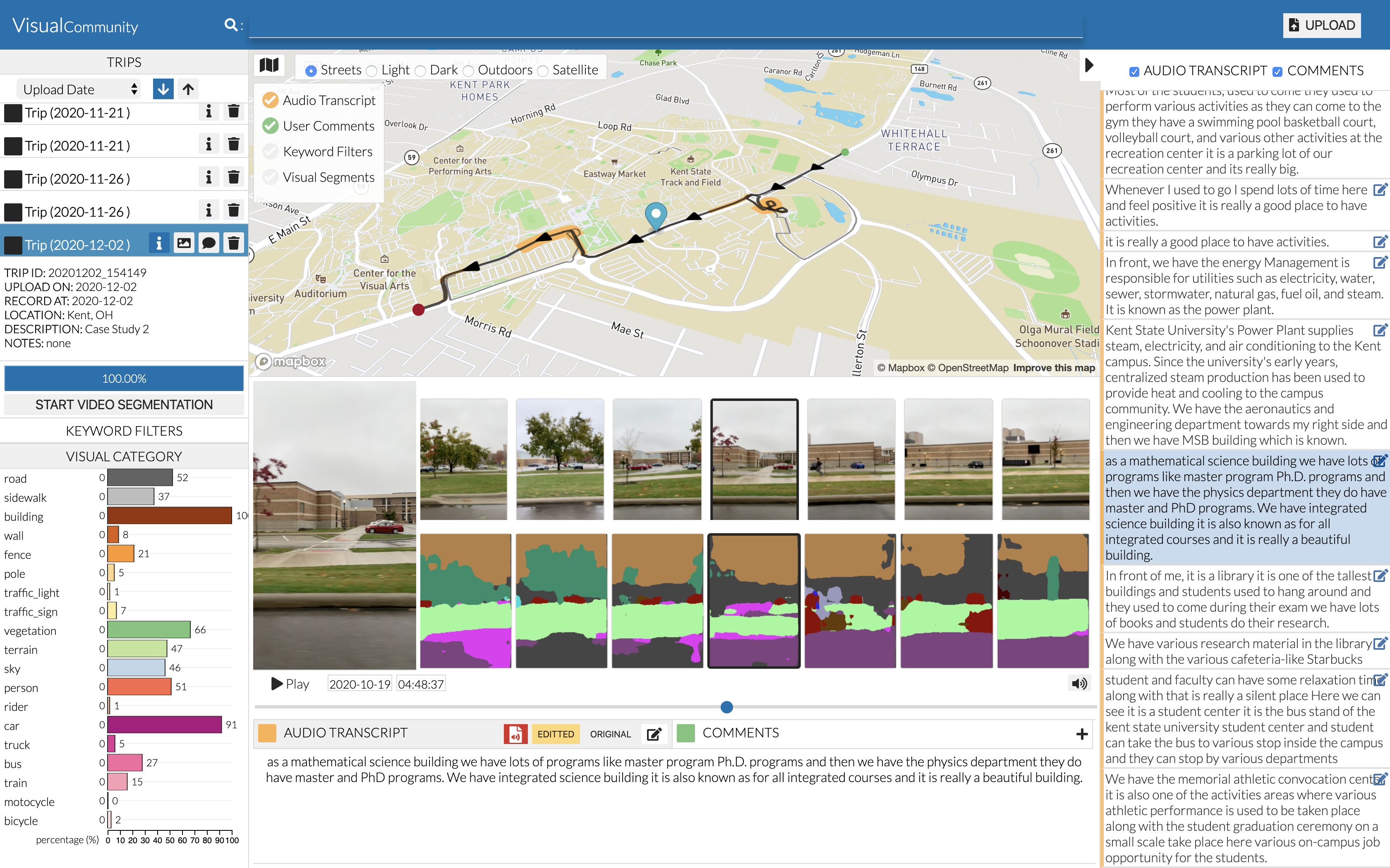
VisualCommunity
Data collection and visualization tool for gaining community knowledge from geo-encoded videos and narratives
SparseTrajAnalytics
An Interactive Visual Analytics System for Sparse Trajectory Data